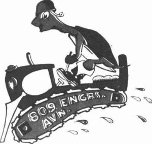
The villagers of Conington were quite surprised when a convoy of the United States Army 809th Egineer Aviation Battalion (EAB) came through their town. No one in Conington knew the reason for them being in town but tents were quickly set up for construction troops. These tents were set up in an area called “The Bell Tent Site”, which had been cleared in the center of a wood known locally as the “Long Spinney’. The tents were square khaki colored tents, and in order to combat the cold, they were lined with timber salvaged from packing cases. Heating was provided by the type of stoves later used in the huts, and to supplement the rationed coke (coal), wood was cut from adjoining woods until stopped by the gamekeeper of the Conington Estate.
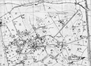
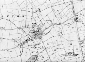
On July 5th of 1942 (or 1943?) in the parish of Conington and on farmland owned by the Rose Court Farm (which stayed an operating farm enclosed by runways) the engineers of United States Army 809th Engineer Battalion (Aviation) started working on what would be Glatton Airfield or Station 130. The name Glatton was chosen over Conington to avoid confusion with Coningsby in Lincolnshire 30 miles away. In the parish of Conington the town of Glatton was the town closest to the Airfield but the town of Holme was closer but was in the Holme Parish. The Airfield was built almost next to the town of Holme. Only the bomb store was located in the Holme Parish and could be seen from the B660. Next to the Airfield was the Old Saint Church of Conington and Conington Castle.
The airfield was located between the LNER East Coast main railway line from London to the north of England and the A1 Great North Road. The small town of Holme had a train station making it easy for the airmen to travel by train during their time off. Another good thing about the location of the airfield was the fact that it was surrounded by four pubs! The Admiral Wells pub was located just outside the airfield limits in the town of Holme. The Addison Arms pub was in the town of Glatton, Crown and Woolpack in the town of Conington and The Oddfellows Arms in the town of Sawtry.
— click on the images for full size photos —
The airbase was constructed to Class “A” standards and although the airfield was completed late 1943 building went on throughout 1944 with the help of local contractors.
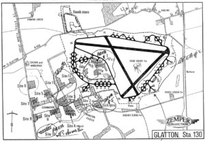
“The British heavy bomber airdrome was accepted as the standard for each field to be constructed by the Americans, with few modifications and a relatively tight clamp on local adjustments. Three runways, each 150 feet wide, were set in a (60 degree) generally triangular form with intersecting legs. The main runway (aligned southwest to Northeast wherever possible) was 6,000 feet long, the other two 4,200 feet each. A fifty-foot perimeter track encircling the runways connected some fifty (loop-type) hardstandings (footnote #1). In addition at each field a 2,500-man “village” had to be build complete with utilities such as sewage-no small problem in the flat lands of East Anglia. At matching airdrome buildings included 214 Nissen huts (16 by 36 feet) arranged in seven living sites, with attendant washhouses and latrines. The technical site adjacent to the runways included some forty-odd buildings for administration, operations and maintenance. Other structures included hospitals, recreation halls and messes. Away from these areas was a “danger site” where a score of buildings housed bombs, fuses and other ordanance. Agreement on Layouts and construction standards was a minor issue compared to problems in actual work.” (from the book Technical Services, the Corps of Engineers, the war against Germany by Alfred M. Beck)
The material needed for building runways suitable for heavy bombers were approximately 18,000 tons of dry cement and 90,000 tons of aggregrate. Expected stress factors of 2,000 pounds per square inch led to runway thicknesses of six to nine inches of concrete slab laid on a hardcore base, covered with a layer of asphalt.
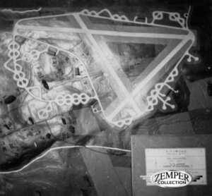
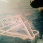
This photo shows the Glatton site plan used by the U.S. Army Corps of Engineers Battalion.
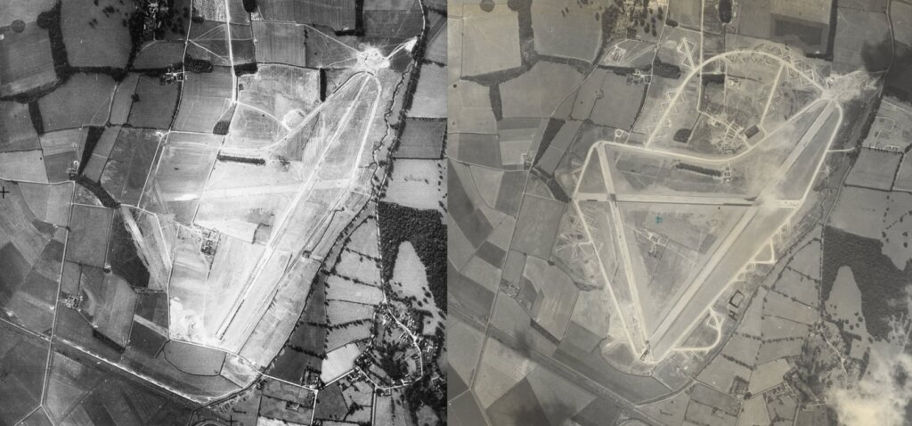
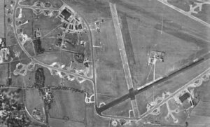
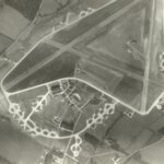
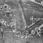
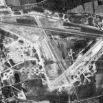
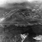
These photos show the airbase being build. You can clearly see that ground work is being done and the outlining of two runways are visible. The right photo shows another photo of the construction but now the runways have been completed and the outlining of the hardstand can be seen.
— click on the image for full size photo —
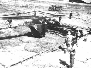
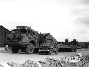
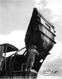
The first photo show the engineers (and local contractors) working on the runways. The second photo shows a large truck probably for moving big machines used for the construction of the base. The third photo shows machinery used for constructing the base.
— click on the images for full size photos —
In the book ‘Bomber Bases of WW2 by Martin W. Bowman’ we get more information about the building proces of Glatton. Bill Ong was a US engineer involved in building airfields in England and this is what he wrote about Glatton:
“Concrete laid, 122,000 cubic yards. Sewer lines, 22,000 feet. Water lines, 29,500 feet. French drains, 24,400 feet. 500 buildings of all kinds were built in concrete, brick, steel and asbestos. Living accommondation for 421 officers and 2473 men was dispered in the countryside around the village of Conington to the south-west of the airfield. Water supply, 120,000 gallons per day. Storm sewers, 67,000 feet. Electric wiring, 450,000 feet. Telephone system, 2,000 calls per day. Sewage plant, 8,000 people per day. Glatton airfield was only 20 feet above sea level and the continuing rain made drainage almost impossible (the airfield was build on very poor quality clay and stone soil too).”
In the History file of the 1061st MP Co (Avn) the ‘mud problem’ is also mentioned:
“When the (1061st MP Co) detachment arrived at AAF Station 130 (Glatton) the weather was bad – nothing but fog, rain, and the mud was so deep in site 5 (this is where the 1061st Mp Co was first quartered and would later be the the site of the 748th BS) and around the base, that no one could venture out unless they had overshoes.”
Mud become such a big problem that at Glatton that ‘MUD CONTROL DAYS’ were introduced, for men and for vehicles.
The airfield was divided in sites. Sites 1 to 6 held the living quarters of the four squadrons, the 468 Sub Depot, 1790 Ordanance Group and the 860 chem. Other sites were the mess sites no. 1 and 2, communal site, W.A.A.F. site, sick quarters site, technical area, bomb dump site AND the sewerage disposal site. The MP’s had a total of four gates to guard. After the 457th BG started using Glatton construction still continued. A few building still needed to be build (like the tractor shed near the control tower) or needed to be finished (like the photo lab).
– FOOTNOTE #1 –
A fifty-foot perimeter track encircling the runways connecting some fifty hard stands which were placed along the perimeter track, made of concrete. Their centres were at least 150 feet (46 m) from the edge of the track and the edges of each hardstand separated from each other and from the funnels by a minimum of 150 feet (46 m). The purpose of the hardstands was to allow aircraft to be dispersed some distance from each other so that an air attack on the airfield would be less likely to destroy all the aircraft at once. Dispersal also minimised the chance of collateral damage to other aircraft should an accident occur whilst bombing-up. Hardstands were either of the Frying-Pan or Spectacle Loop type, with the Spectacle type being the easiest in which to manoeuvre aircraft.
— click on the image for full size photo —


